Blog
Drone Data Integration with GIS
Transforming Spatial Intelligence for Smarter Decisions
In today’s fast-paced digital world, Drone Data Integration with GIS is revolutionizing how industries collect, analyze, and utilize geospatial information. From infrastructure development and mining to agriculture and smart city planning, integrating drone-generated data with Geographic Information Systems (GIS) enables accurate, real-time, and data-driven decision-making.
If your business relies on mapping, surveying, environmental monitoring, or land management, drone and GIS integration can significantly enhance project efficiency, accuracy, and cost-effectiveness.
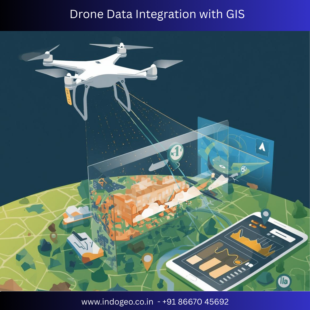
What is Drone Data Integration with GIS?
Drone data integration with GIS refers to the process of collecting high-resolution aerial data using drones (UAVs) and incorporating that data into GIS platforms for advanced spatial analysis, visualization, and reporting.
Drones capture:
High-resolution aerial imagery
Orthomosaic maps
Digital Elevation Models (DEM)
Digital Surface Models (DSM)
3D terrain models
LiDAR data (where applicable)
These datasets are then processed using GIS software like ArcGIS and QGIS to generate actionable insights.
Why Drone and GIS Integration Matters
1. High-Precision Data Collection
Drones provide centimeter-level accuracy, making them ideal for detailed land surveys, volumetric analysis, and infrastructure monitoring.
2. Faster Project Execution
Traditional survey methods can take weeks. Drone surveys reduce fieldwork time significantly, enabling faster GIS mapping and reporting.
3. Cost-Effective Solutions
By minimizing manpower, equipment costs, and time, drone-GIS integration offers a highly economical alternative to conventional survey techniques.
4. Real-Time Monitoring
GIS platforms allow continuous updates from drone flights, helping project managers monitor progress and detect changes instantly.
Key Applications of Drone Data Integration with GIS
🏗 Construction & Infrastructure
Site planning and land assessment
Cut & fill analysis
Progress monitoring
3D modeling of structures
🌾 Agriculture & Precision Farming
Crop health monitoring
NDVI analysis
Irrigation planning
Yield estimation
⛏ Mining & Quarrying
Stockpile volume calculation
Terrain mapping
Environmental compliance monitoring
🌍 Urban Planning & Smart Cities
Land use mapping
Utility mapping
Traffic and road network analysis
Disaster risk assessment
🌊 Environmental & Water Resource Management
Floodplain mapping
Watershed analysis
Coastal erosion studies
How Drone Data is Integrated into GIS – Step-by-Step
Drone Survey Planning – Define flight path and ground control points (GCPs).
Data Acquisition – Capture aerial imagery and geospatial data.
Data Processing – Convert raw data into orthomosaic maps and 3D models.
GIS Integration – Import processed data into GIS software.
Spatial Analysis – Perform measurements, modeling, and interpretation.
Reporting & Visualization – Generate maps, dashboards, and technical reports.
Benefits for Businesses and Government Projects
Enhanced accuracy and reliability
Improved decision-making with data visualization
Better compliance with regulatory standards
Reduced operational risks
Sustainable land and resource management
Government departments, infrastructure developers, mining companies, and environmental consultants are increasingly adopting drone GIS solutions for better planning and monitoring.
Technologies Powering Drone GIS Integration
Modern drone mapping relies on:
RTK & PPK positioning systems
LiDAR sensors
Multispectral imaging
Cloud-based GIS platforms
AI-powered spatial analytics
When integrated properly, these technologies create a powerful geospatial intelligence ecosystem.
Future of Drone Data Integration with GIS
The future lies in automation, artificial intelligence, and real-time data synchronization. With advancements in machine learning and 5G connectivity, drone-to-GIS integration will enable instant mapping updates, predictive analytics, and smarter infrastructure management.
Industries that adopt drone GIS technology today gain a competitive advantage through improved efficiency, precision, and scalability.
Conclusion
Drone Data Integration with GIS is not just a technological trend — it is a transformative solution for modern surveying, mapping, and spatial analysis. By combining high-resolution aerial data with advanced GIS tools, organizations can unlock deeper insights, optimize resources, and accelerate project success.
Whether it’s construction, agriculture, mining, or environmental management, integrating drone data with GIS ensures smarter planning, better monitoring, and sustainable development.
Comments


Scroll to Top